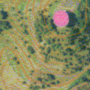
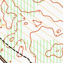
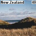
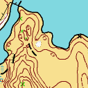
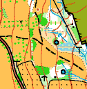
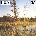
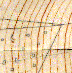
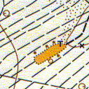
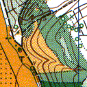
 Our last mapping in New Zealand was several kilometers north from Murawai (story no. 38). The black sand terrain was generally flat however with many wind formed shapes. The shallow parts made mapping difficult, our basemap usually did not show anything in these places.
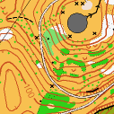
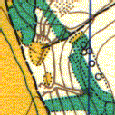
 Auckland the biggest city of New Zealand was settled on a quite active volcanic area (in geological terms). There are 48 small now silent volcanoes scattered around the windy city. Big King is one of these cones also with craters that tower above Auckland and serve as a public park.
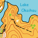
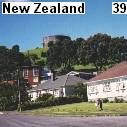
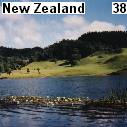 Our first touch with New Zealand countryside was on the Murawai beach (a one hour drive northwest from Auckland). This straight long shore is covered with soft black sand that is regularly washed by the mighty tides of Tasman Sea.
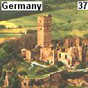 It was freezing and the small castle town of Konigstein im Taunus was in cheerful Advent mood. We were instead jollying in Christmas decorated streets mapping nearby castle complex, parks, meadows and forest.
 The Prospect Hill in the Waterloo Recreation Area was green. Thorny shrubs usually grow on places with a lot of sunshine - in this case on a former sunny golf course. The most obvious objects you could put a control on were nesting boxes on poles.
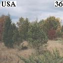
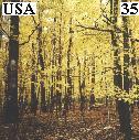 Mainly leafy forest turned in the late October yellow and red. Gold above, gold beneath, maple leaves were falling down and rustling on ground. That was the "indian summer 2002" we spend mapping together (Ales and Vendy) in Michigan.
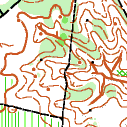
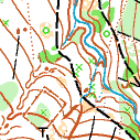
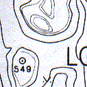
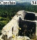 Radyne is a characteristic landmark on Pilsner horizon. It is a ruin of a medieval castle that was founded by the emperor Charles IV. The surrounding stony forest gradually raises to a rocky top. On the top in the middle of the map there is the castle Radyne.You can distinguish there an old fortification ramparts and moats. It is the highest peak of local countryside - 567 meters above sea level.
 In the southern part of Sumava Mountains we made a small map for scouting purposes. My beloved ranger girlfriend Vendula invited me to organize a cartography workshop there. Snail, Il-tchi, Raccoon, Dino, Cub, Beaver, Dolphin, Andy, Nancy, Spy, Mosquito (nicknames) tried to make their first map.
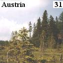 Maltese knights run downhill and cross-country ski resort Hebalm (southern Austria) - 1294 meters above the sea level. Seasonally very busy sporty place however in springtime (when we used to be there) the mountains are very quite and desolate.
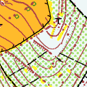
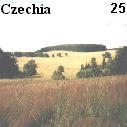
 Czech highland Vysocina is typically rich in details - sundry vegetation, winding brooks, marshes, sometimes rocks and stones.
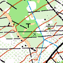
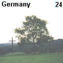
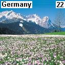
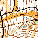
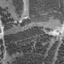
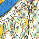
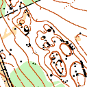
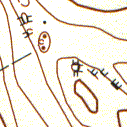
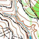
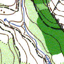
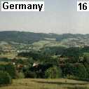
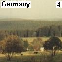
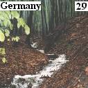 Our task was to make two orienteering maps of similar neighboring terrains by Kassel in Germany. Beech forest was covering most of the forest. Other parts (spruce) were usually very thick.
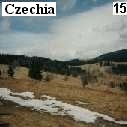
 Again in the Jeseniky Mountains (see no. 15) mapping long slopes with many stony knolls and rocks.
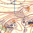
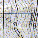
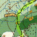
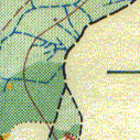
 The founder of the mapped forest preserve (and the preserve itself) is called Waterfall Glen. That had been causing some misunderstandings. People had thought a waterfall should be there. So they had made a small one.
The vegetation is bushy with several large rough open areas that offer fine control points. On the southwestern side of the map you can find a Hindu temple, artesian well, water shaped contours and a dry rocky canyon. I suppose there must be a real waterfall in the spring when the water flows down.
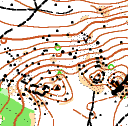
 On the southwestern side of Chicagoland where the Calumet River flows through a hilly countryside there are several nice orienteering terraines. Palos North is one of them.
The upper plateau with many lakes as Tomahawk Slough, Bull Frog Lake or Maple Lake is trimmed by undulating inclines. The hilly area is mostly covered with thick forest.
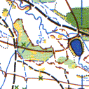
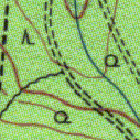
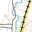
I worked partially with a photogrammetry basemap. It was quite accurate but I could not absolutely rely on it. I did some changes as you can see on the pictures. US A-meet April 2002.
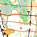
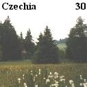
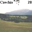
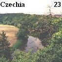
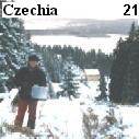
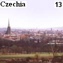
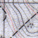
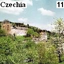
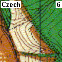
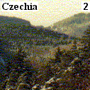
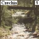
 The 5th World Rogaining Championships 2002 take place in the Czech Republic.
Rogaining is rather new orienteering sport with emphasis on cross-country navigation in large areas. Teams (2-5 members) try to find as many checkpoints as possible in 24 hours.
I prepare the maps. The whole competition area is about 170 square kilometers and is situated on the western border with Germany in Cesky les.
The highland (500-900 meters above the sea level) is mostly covered with forests. There are no expressive terrain details, several rocky areas, marshes, ruines of old villages. There live very few people because of the protected border before 1989.
It is a nice forgotten part of the Czech Republic. Come and see.
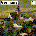
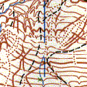
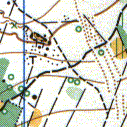
 It was for the second time I checked a piece of land in Pechbrunn (see no. 10).
I stayed exactly in the mapped area by the O-family Dohlers.
It was for the second time I checked a piece of land in Pechbrunn (see no. 10).
I stayed exactly in the mapped area by the O-family Dohlers.
The terrain gently rises to a basalt quarry, where you can find interesting man-formed contours. The quarry is connected with the village by a tube that transports stones to a railway station. On both sides of the tube grow huge plants - Heracleum mentegazzianum. Metternich brought them to this region in the 19th century as a green shield for pheasants.
The whole plant is very poisonous and is spreading to other parts of Germany and Czech Rep. Bayern Relay Championships 2001.
 13 members of our club surveyed during the spring 2001 on both side of the river Berounka 7 square kilometers.
It is wonderful that such a beautiful landscape is so close to Plzen (the fourth largest city of the Czech Republic).
On the map there is a variety of terrains that offers difficult course setting such as narrow gorges, flat parts and steep hillsides with rock pillars and boulders.
On these slopes you can even see a mouflon.
I swam to a small island in the Berounka river on the last survey-day and checked 14 672 square meters of bushy land that contained 1 knoll, 1 depression, 1 pit and 7 distinct trees.
 Rain. Drizzle. Rain. - Cloudy March 2001 in the woods of southern Bayern (Germany).
Continental type of vegetation combined with glacial terrain - many small hills, valleys, ridges but nearly no stones and rocks. On the other hand a dense communication net makes the running in this difficult terrain easier.
When the weather allowed it we could see a long range of huge mountains in the south - the Alps.
TSV Grunwald organized there in July 2001 the Bayern Championships.
 There are not too many places to organize a ski orienteering event in the Czech Republic. A suitable cross country ski center and
favorable snow conditions are the only limits. Therefore, it is not an easy task to find a totally new ski-o terrain.
There are not too many places to organize a ski orienteering event in the Czech Republic. A suitable cross country ski center and
favorable snow conditions are the only limits. Therefore, it is not an easy task to find a totally new ski-o terrain.
Our sport club found it in the Krusne hory, on the northwest border with
Germany. This is one of the range of mountains that forms the characteristic shape of the
Czech Republic.
It was in the time of first snow one week before Christmas 2000. Seven members of our club, in the heights between 875 and 1110
meters above the sea level, surveyed 21 km2. Forest combined with open land, peat bogs, tiny pine trees, wolf pits (made by tin miners
in the 19th century).
The work was focused especially on the communication network and open land features. Because of aerial photos and simplifying approach,
it took only two days to survey it.
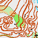
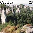 The annual meeting of the Czech Cartography Committee took place in the sandstone terrains in the northern part of the Czech Republic.
Its mission is to train new cartographs and to develop mapmaking standards.
The annual meeting of the Czech Cartography Committee took place in the sandstone terrains in the northern part of the Czech Republic.
Its mission is to train new cartographs and to develop mapmaking standards.
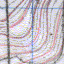
Twelve experienced cartographers from the whole country surveyed the same piece of land. Different approaches and tolls as compasses,
altimeters, range finders, GPS brought different views how to percept a countryside.
 The river Isar springs in the Alps, flows through Munich and empty into the Danube River. Fragments of minerals tint the river dark
green.
The river Isar springs in the Alps, flows through Munich and empty into the Danube River. Fragments of minerals tint the river dark
green.
The countryside in the south of Munich, direction Grunwald is very flat (see no.12). One of the exceptions is a steep valley of the river Isar.
The strong current formed on its banks many terrain details.
Other things were pebble beaches on both sides of the river. Naked naturalists were catching here last beams of the late summer 2000.
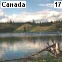
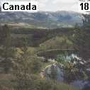 Nine-hour flight from Europe and you are in the pristine wilderness, in the gold rush country - the Yukon in Canada.
The capital Whitehorse is lost in never-ending forests of the very North America.
Nine-hour flight from Europe and you are in the pristine wilderness, in the gold rush country - the Yukon in Canada.
The capital Whitehorse is lost in never-ending forests of the very North America.
Variety of Scandinavian type of terrains that were shaped by glaciers, real wildlife next-door, hidden lakes with beavers, moose, eagles and bears.
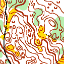
I started survey round the Mount McIntyre Recreation Center where was the World Cup 1996 in cross-country skiing.
The accuracy of the basemap was not too high, so the work was rather challenging. Yukon Championships 2000.
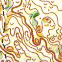
 On the right bank of the Yukon river there is the second terrain I worked in - Chadburn lake, Hidden lakes, full of depressions, knolls,
lakes and sandy slopes.
On the right bank of the Yukon river there is the second terrain I worked in - Chadburn lake, Hidden lakes, full of depressions, knolls,
lakes and sandy slopes.
The basemap was very good. I only reworked vegetation and expressed (suppressed) some terrain shapes
to make the map more understandable to a orienteerer.
There is round 15 000 bears in the Yukon, they are said to be peaceful but sometimes I didn't fell too safe. Pepper spray, jingle
and my loud voice were the only things to scare them. And my imagination: "I am hitting a huge grizzly with the sharp edge
of my compass," that finished it of course. In fact I saw 6 bears and all of them survived.
 Meadows with scattered fruit trees, apple and pear orchards, grassy highlands full of frisking horses and sleepy cows. In the south of Frankfurt -
Hessen, Odenwald.
Meadows with scattered fruit trees, apple and pear orchards, grassy highlands full of frisking horses and sleepy cows. In the south of Frankfurt -
Hessen, Odenwald.
 The Jeseniky Mountains, a border range in the northeast of Czech Republic. It was one-hour walk from my base to the mapped area,
higher and higher from 500 meters above the sea level to 900 meters.
The Jeseniky Mountains, a border range in the northeast of Czech Republic. It was one-hour walk from my base to the mapped area,
higher and higher from 500 meters above the sea level to 900 meters.
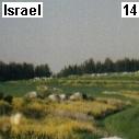 In March 2000 the Israeli Orienteering Association (ISOA) invited me to the heart of Israel.
Karmei Yosef - settlement on the halfway from Tel Aviv to Jerusalem. Right here fought David with Goliath.
In March 2000 the Israeli Orienteering Association (ISOA) invited me to the heart of Israel.
Karmei Yosef - settlement on the halfway from Tel Aviv to Jerusalem. Right here fought David with Goliath.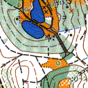
 The heart of the map Lobokros is a hilly park - a recent quarry.
 Three km from the center of Munich (Germany) there is a 25 sq. kilometer large forest. Totally flat,
divided into regular squares
by vehicle tracks. The only terrain objects there were 15 meters wide circle depressions caused by bombing
during the World War II.
Three km from the center of Munich (Germany) there is a 25 sq. kilometer large forest. Totally flat,
divided into regular squares
by vehicle tracks. The only terrain objects there were 15 meters wide circle depressions caused by bombing
during the World War II.
The vegetation out of the paths was very dense; thorns of blackberries were too sharp.
 Some Czech regions suffer from a lack of new orienteering terrains as for example the surroundings of Prague.
Everything had been already surveyed there. Only the Westbohemian forests seem to be full of new interesting
orienteering terrains. One of them is in Becov nad Teplou.
Some Czech regions suffer from a lack of new orienteering terrains as for example the surroundings of Prague.
Everything had been already surveyed there. Only the Westbohemian forests seem to be full of new interesting
orienteering terrains. One of them is in Becov nad Teplou.
Bigger and smaller knolls with boulders all round the map; steep hillsides with rock cliffs. You have to be in a very
good condition and work carefully with the detailed map to finish successfully a competition.
On this map there was one of the best-evaluated orienteering competition in Czech republic in 1998.
During my work here I had been hearing strange terrible voices. It sounded like a killing of innocent babies.
At the end I found out that this voice comes from an eagle owl.
 It's the last time I am going through the forest by Pechbrunn in Germany, July 1998.
It's a map I wholly made alone, 8 sq. km. The terrain is hilly with many vehicle tracks and paths; the growth
is nearly unrunnable.
It's the last time I am going through the forest by Pechbrunn in Germany, July 1998.
It's a map I wholly made alone, 8 sq. km. The terrain is hilly with many vehicle tracks and paths; the growth
is nearly unrunnable.
The orienteering club of my host family organized here in autumn
1999 a
big orienteering event for the whole Germany.
I am looking to my handmade map and at once an old nimble man started to talk with me in a Bayern dialect.
"Please more slowly." He talks about a Czech sportsman Emil Zatopek, who won three golden Olympic medals in
1952 (5 km, 10 km, marathon);
about today lazy young people; about a birthday.
I am proud of my German language skills so I started to shake his hands and congratulate him, when I had heard
something about birthday.
It surprised him, on this day celebrated the 75th birthday the Czech sportsman Emil Zatopek.

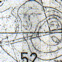
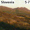
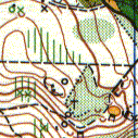
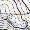
![]() In April 1998 in the time of the last shivering of winter I went again to Slovenia, where all
plants were already green. By the town Maribor at the foot of the range Pohorje.
In April 1998 in the time of the last shivering of winter I went again to Slovenia, where all
plants were already green. By the town Maribor at the foot of the range Pohorje.
Mountain with no end. On these hillsides the World Cup downhill
skiing competitions take annually in winter place.
Sometimes it was too steep. I was to fall and roll down. Clear beech forest with many deep gorges.
I cannot explain the origin and meaning of those gorges till now (they were obviously manmade).
I had seen many of tiger salamanders. The nature there was unspoiled and nice.
The mushroom cream soup was excellent.
![]() The western part of Czech republic is surrounded in all directions by Germany. And in this region 1 km
to the border came to existence another map Nebesa.
The western part of Czech republic is surrounded in all directions by Germany. And in this region 1 km
to the border came to existence another map Nebesa.
There are only three ways how to get to As - two roads and a railway, everything is on the mapped
terrain, even the electricity connection. The access to this region was only with
a special permission till the year 1989 . Because the communist regime was aware of an uncontrolled emigration to
western Germany.
A wavy marshy terrain in the south flavored by a rocky ridge with a cave. In this cave 3 meters
above the normal ground there was during the orienteering competition in spring 1999 a control. It was
rather difficult to get there. This range of mountain Smrciny continues to Bayern (the
highest peak is Schneeeberg 1005 m).
 In the summer 1997 I had finished a map close to my hometown - Plzen. The forest was full of deer.
It was a special type of a deer called Sika and that is the name of the map.
In the summer 1997 I had finished a map close to my hometown - Plzen. The forest was full of deer.
It was a special type of a deer called Sika and that is the name of the map.
It was not the first orienteering map in this terrain, already in 1972 and 1985 other mappers had
surveyed this forest. So it is interesting to compare their survey approach and mine.
The terrain is still the same but the contour shapes differ.
The vegetation is also year by year different.
 Ilirska Bystrica 1997, a small town or better a summer resort on the way to the Meditarian in
southern Slovenia.
Ilirska Bystrica 1997, a small town or better a summer resort on the way to the Meditarian in
southern Slovenia.
The mountain range was 600-800 meters above the sea. Big and deep depressions 20-30 meters -
upside-down hills.
From the trees were hanging living green ropes, poison scorpions were bathing in the sun - a Slovenian
idyll. Because there were nearly no paths and tracks I had to use toilet paper to mark my orientation points.
It was very funny.
After a fortnight my shoes looked like I had been using them for a year - totally destroyed. The local dogs
were dangerous. They bite.
 The first time I surveyed out of Czech republic - in central Germany in Thuringen in Ilmenau in 1996,
where lived part of his life the classical author - J.W.Goethe. He marked here the tourist routes, so well - colleague.
Dense communication net, the forest was bushy, the terrain hilly but without any clean-cut shapes.
The first time I surveyed out of Czech republic - in central Germany in Thuringen in Ilmenau in 1996,
where lived part of his life the classical author - J.W.Goethe. He marked here the tourist routes, so well - colleague.
Dense communication net, the forest was bushy, the terrain hilly but without any clean-cut shapes.
Their definition of special symbols: brown crosses for fox lairs and anthills; black crosses
for banks and anthills rounded by a fence; Black circles for plateaus (you needn't to cut off condolines)
Characteristic features of this landscape were 10-20 wide narrow rides going over hills and valleys.
![]() Vast forests by Marienbad with romantic names as - Three Axes and Blackbird stream.
In the map area there is a forgotten Jewish cemetery and not far away from here is a spring of a mineral water.
I surveyed in this central European forest 10 sq. km.
Vast forests by Marienbad with romantic names as - Three Axes and Blackbird stream.
In the map area there is a forgotten Jewish cemetery and not far away from here is a spring of a mineral water.
I surveyed in this central European forest 10 sq. km.
In the southern part there is a military ground. Once I went there with my friend to angle. The night was quite.
But immediately some tanks started to circle on the exercise ground. Our only way home led through this ground.
I felt as a soldier but we survived.
 In the cold winter 1996 I had finished the map Hubertus west of the thermal spa Karlsbad.
This terrain geologically belongs to the volcanic range Doupovske hory.
There are two dominants on this map, two cones - Beech and Grass hill. Nearby is a medieval castle ruin Angel hill,
which was devastated from the Swedish troops in the 17th century.
Steep hillsides fall in the north to the Ohre river and in the south smoothly come to a Czech famous golf resort.
In the cold winter 1996 I had finished the map Hubertus west of the thermal spa Karlsbad.
This terrain geologically belongs to the volcanic range Doupovske hory.
There are two dominants on this map, two cones - Beech and Grass hill. Nearby is a medieval castle ruin Angel hill,
which was devastated from the Swedish troops in the 17th century.
Steep hillsides fall in the north to the Ohre river and in the south smoothly come to a Czech famous golf resort.
 I started making and surveying maps rather early at the age of 16 in 1995 by Horni Slavkov on the map
Podes. My father Josef Hejna had already finished mainly in the region of West Bohemia 16 orienteering maps.
He taught me how to survey.
I started making and surveying maps rather early at the age of 16 in 1995 by Horni Slavkov on the map
Podes. My father Josef Hejna had already finished mainly in the region of West Bohemia 16 orienteering maps.
He taught me how to survey.
Tin and uranium used to be mined in these deep forests till 1966. The countryside is hilly, bushy with many mining relicts.
There is even a stream that disappears in a stony ground. The whole range of Slavkovsky les has a strange atmosphere.
The every day life after the Second World War has never reached the old intensity.